- 9594 NW 41 Street Suite 201 Doral, FL 33178
This type of work provides horizontal and vertical control to a specified standard for Department projects.
This type of work includes boundary surveys, right of way surveys, as-built surveys, construction layout surveys, topographic surveys, hydrographic surveys, quantity surveys, record surveys, mean high water line surveys, and special purpose surveys.
This type of work includes the production of right of way related maps, as well as the preparation of legal descriptions and sketches of legal descriptions based on information supported by the applicable surveys or maps defined in the preceding types of work, title searches, and other documents.
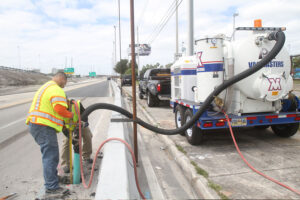
Many States utilize consultants to identify the quality of subsurface utility information needed for highway plans, and to acquire and manage that level of information during the development of highway projects.
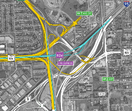
SR 826 to NB I-95 Ramp Connector
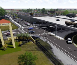
Signalization & Lighting
Signalization & Lighting
Signalization & Lighting
SR 826 to NB I-95 Ramp Connector
Signalization & Lighting
Signalization & Lighting
Signalization & Lighting